Lucipara: The 2026 Breakthrough to Protect Indonesia’s Wildest Atoll

Some of the ocean’s most important places are the ones you’ve never heard of. Lucipara is one of them.
Tucked into the open Banda Sea, this tiny island group has no permanent residents, no resorts, and no roads. But beneath its turquoise surface lies a reef system so healthy that scientists take notice—and a turtle population so significant that it has triggered one of Indonesia’s most closely watched conservation efforts. In this updated guide, you’ll learn exactly where things stand as of November 2026, what the latest survey found, and why this obscure atoll suddenly matters to anyone who cares about the future of the ocean.
Quick Overview: The State of Play (November 2026)
- The place: A three-island atoll in Maluku, Indonesia, roughly 50 km west of the Penyu Islands.
- The plan: A 388,712.10-hectare marine protected area (MPA) is being designed around it.
- The latest news: A landmark integrated survey ran from 15–29 October 2026 across eight scientific and social parameters.
- The legal anchor: The area is already reserved in Maluku’s Provincial Spatial Plan (Perda No. 2/2025, covering 2025–2044).
- The new partner: A February 2026 co-management deal with Blue Alliance Indonesia puts Lucipara alongside five other Maluku MPAs under long-term management.
- The deadline: A roadmap agreed in March 2026 targets 2028 for the MPA to be fully operational.
What Is Lucipara—and Why Is It Suddenly on the Map?
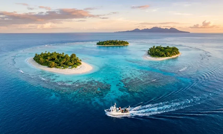
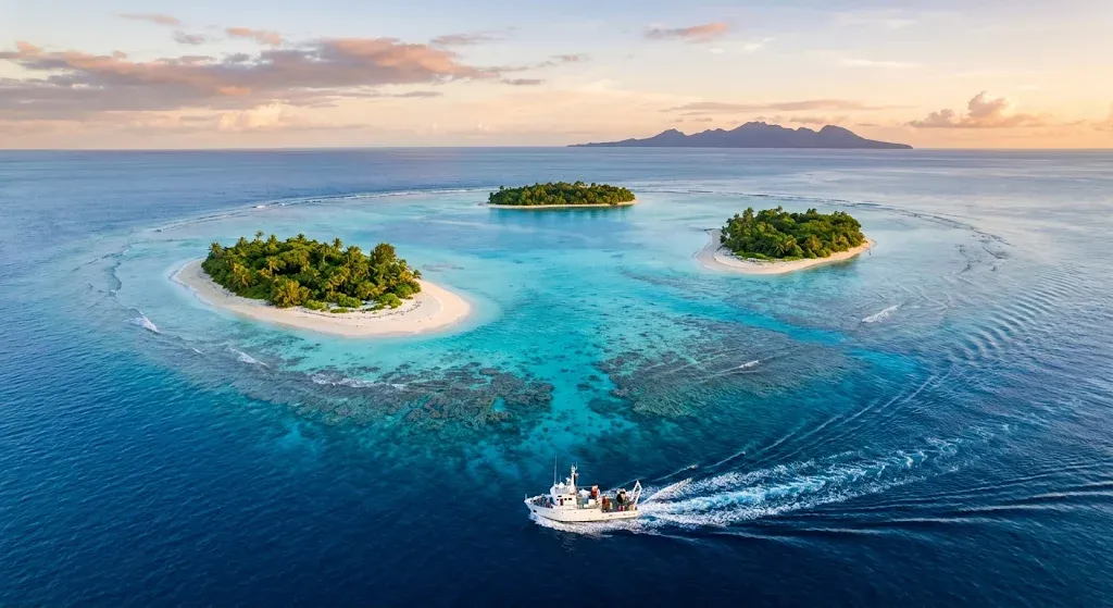
Definition: Lucipara (Kepulauan Lucipara) is a small, uninhabited atoll in Indonesia’s Maluku province. It consists of three main islands—Pulau Selatan, Pulau Kaurangka, and Pulau Mai—and sits in the Banda Sea, south of the Manipa Strait and near Seram.
For most of modern history, Lucipara was a footnote—a name on nautical charts, a coconut-harvesting stop for nearby communities. That changed in 2026. What was once a quiet, overlooked reef system is now the focus of a coordinated push by the Maluku provincial government, national research agencies, and international conservation groups to designate it as a formal marine protected area.
The shift didn’t happen overnight. It followed years of field observations—including a 2021 expedition by the Coral Triangle Center—that documented high numbers of sharks, sea turtles, and large reef fish. Those findings made it clear that Lucipara wasn’t just another remote island. It was a functioning, high-biodiversity marine ecosystem in a region where such places are increasingly rare.
Where Is Lucipara, and What Makes It Ecologically Special?
Lucipara sits in the Banda Sea, about 50 kilometres west of the Penyu Islands and close to the Manipa Strait. It’s part of the Maluku archipelago, squarely inside the Coral Triangle—the global epicentre of marine biodiversity.
The atoll’s ecology is defined by three features:
Healthy coral reefs. The reefs around Lucipara have shown medium to high coral cover and fish populations with high biomass, including large predatory species that are often missing from heavily fished areas.
Sea turtle nesting grounds. The islands’ beaches are used by green turtles and hawksbill turtles. A 2021 rapid survey recorded more than 1,100 turtles in just four days of manta-tow surveys—a striking concentration for such a small area.
Deep-water seamounts. Underwater mountains rise from the seafloor nearby, influencing water movement and nutrient availability. These features make the area a migration corridor for whales and a habitat for large marine mammals.
Put simply, Lucipara is not just a pretty reef. It’s a working ocean system—and one that still has its top predators intact.
The October 2026 Survey: What Was Actually Measured?
If you want to know what’s new, start here. From 15 to 29 October 2026, a multi-institutional team conducted the most comprehensive scientific assessment Lucipara has ever seen. It wasn’t just a fish count. It covered eight distinct parameters:
- Benthic habitat mapping — what lives on the seafloor.
- Mangrove and seagrass monitoring — critical nursery ecosystems.
- Marine mammal and sea turtle tracking — movement and abundance.
- Fish spawning aggregation site identification — where fish reproduce.
- Spatial fisheries usage — how and where people fish.
- Blue carbon stock assessment — how much carbon the ecosystem stores.
- Coral reef resilience — how well reefs can recover from stress.
- Community climate change adaptation — how local people are responding to environmental shifts.
The survey wasn’t limited to Lucipara itself. Teams also worked around Pulau Teon, Pulau Manuk, Pulau Hatta, and Pulau Manukang—a broader cluster of islands in the Banda Sea. Partners included the Maluku Maritime Affairs and Fisheries Agency (DKP Maluku), YKAN, the Coral Triangle Center, BRIN, local universities, and community representatives.
The data collected is now being analysed. It will form the scientific basis for the zoning plan—the rules that will determine which areas are strict no-take zones, which allow limited fishing, and which may be open to controlled tourism.
Why the 2026 Survey Matters More Than Previous Efforts
Lucipara has been studied before. So why does this survey carry more weight?
Because the stakes are higher. DKP Maluku has reported that repeated surveys show a decline in ecosystem quality in the area, including damage from blast fishing. The October 2026 assessment was explicitly designed to update the baseline—to replace old data with current, on-the-ground evidence before zoning lines are drawn.
There’s also a policy window. Indonesia has a national target of expanding marine protected areas from about 30.9 million hectares today to 97.5 million hectares by 2045. Maluku’s provincial government has committed to contributing to that target, and Lucipara is one of its flagship sites. The survey is the technical step that makes the political commitment actionable.
As YKAN’s Marine Program Director, Muhammad Ilman, put it: an effective conservation area is not built on perception—it’s built on scientific evidence.
The Legal and Political Backing: From Spatial Plan to Co-Management
A survey alone doesn’t protect anything. What makes Lucipara different in 2026 is the legal architecture that now surrounds it.
The spatial plan. Lucipara’s waters have been formally reserved in Maluku’s Provincial Spatial Plan (Perda No. 2/2025), covering 2025–2044. That means the 388,712.10-hectare area is already allocated for conservation purposes in provincial law.
The Blue Alliance deal. On 12 February 2026, the Maluku provincial government signed a long-term co-management agreement with Blue Alliance Indonesia covering 1.5 million hectares across six marine conservation areas. Lucipara is one of the six, alongside Romang, Damer, Tanimbar, South Buru, and Kur Tayando Tam. The model is built for permanence: sustainable fisheries and blue carbon are meant to generate recurring revenue, with donor support acting as a spark rather than the fuel.
The 2028 roadmap. At a meeting in Sanur, Bali, on 2–3 March 2026, DKP Maluku, the Coral Triangle Center, and YKAN agreed on the initial structure of a management roadmap running until 2028. The roadmap includes seven components, from forming a consortium to strengthening human resources and developing sustainable financing.
This is the difference between a good idea and a functioning protected area. Lucipara now has both.
The Threats That Haven’t Gone Away
Conservation planning is only useful if it confronts the pressures that make protection necessary. Three threats remain central.
Blast fishing
The use of explosives to kill or stun fish is the most immediate danger. It shatters coral structure, kills juvenile fish indiscriminately, and undermines the very reef that supports local fisheries. The Coral Triangle Center has explicitly warned that explosive fishing “depletes fish stocks and destroys coral reefs” around Lucipara. DKP Maluku’s repeated surveys have recorded ecosystem decline linked to the practice.
Enforcement in remote waters
Lucipara is far from population centres, which makes routine patrols expensive and logistically difficult. The new MPA framework is meant to create formal management authority and patrol responsibilities—but those systems are still being built.
Climate exposure
The atoll is low-lying and sits in the open sea, making it vulnerable to storm surges and sea-level rise. Its reefs also face the global threat of warming-driven bleaching. As DKP Maluku’s Erawan Asikin noted, the island’s flat topography and exposed location make climate change a “very large” threat. Protecting against local pressures won’t solve climate change, but it gives the ecosystem a better chance of withstanding it.
What This Means for Tourism—and for Local Livelihoods
Lucipara is not being designed as a no-go zone. The plan explicitly aims to balance protection with sustainable economic use, including low-impact marine tourism.
The model being studied is Tubbataha Reefs Natural Park in the Philippines—a UNESCO-listed marine park that supports premium liveaboard dive tourism while enforcing strict conservation rules. The comparison isn’t perfect, but the principle is the same: tourism revenue can fund enforcement, and enforcement protects the resource that tourists come to see.
Crucially, the planning process has included social and economic surveys. The October 2026 assessment looked at spatial fisheries usage and community climate adaptation precisely because non-resident fishers from neighbouring islands rely on Lucipara’s waters as a traditional fishing ground. Zoning that ignores those livelihoods would be both unfair and unenforceable.
The long-term vision, as articulated by provincial officials, is a marine tourism destination that contributes to regional revenue without exceeding the area’s ecological carrying capacity. That’s easier said than done—but it’s the right goal.
What Happens Next? The Road to 2028 (and Beyond)
The October survey is finished. The data is being processed. So what should you watch for?
Late 2026 – early 2027: Analysis of the eight-parameter dataset. The findings will be socialised with stakeholders in Maluku before zoning boundaries are finalised.
2027: Drafting of the MPA management plan and zoning regulations. This is where the scientific data becomes legal rules. Public consultation will matter enormously here.
2028: The target year for Lucipara to be functioning as a managed marine protected area, with patrol capacity, financing mechanisms, and community engagement structures in place.
None of this is guaranteed. Marine protected areas often exist on paper long before they exist in practice. But Lucipara now has something many similar initiatives lack: fresh data, formal legal backing, a multi-year roadmap, and a coalition of partners with a long-term co-management agreement. That’s a stronger starting position than most.
Key Takeaways
- Lucipara is a remote, uninhabited atoll in the Banda Sea, known for healthy reefs and important sea turtle nesting beaches.
- A 388,712.10-hectare MPA is being designed around it, anchored in Maluku’s 2025–2044 spatial plan.
- A comprehensive survey (15–29 October 2026) assessed eight ecological and socio-economic parameters to guide zoning.
- Blast fishing and climate exposure are the most pressing threats to the ecosystem’s future.
- A 2028 roadmap and a 1.5-million-hectare Blue Alliance co-management deal provide the institutional framework for long-term protection.
FAQ
What is the latest news on Lucipara?
A major integrated survey concluded on 29 October 2026, collecting data on eight ecological and social parameters. The results will inform the zoning plan for a 388,712-hectare marine protected area, with a roadmap targeting 2028 for full management.
Where exactly is Lucipara?
It’s in Indonesia’s Maluku province, in the Banda Sea, about 50 kilometres west of the Penyu Islands and near the Manipa Strait. The atoll is uninhabited and consists of three main islands.
Why is Lucipara important for conservation?
Its reefs are among the healthiest in Indonesia, with high coral cover and intact predator populations. Its beaches are used by green and hawksbill turtles, and the surrounding deep water supports whales and sharks.
Is Lucipara the same as the Lucipar estate in Paraguay?
No. “Lucipar” in Paraguay refers to a land estate involved in a separate agrarian conflict. Lucipara, ending in “a,” is the Indonesian atoll discussed here.
Can tourists visit Lucipara?
Not yet in any organised way. There is no tourism infrastructure, and access is limited. Future plans focus on low-impact marine tourism modelled partly on Tubbataha in the Philippines, but any development will be regulated under the MPA framework.
What is the biggest threat to Lucipara’s reefs?
Blast fishing is the most immediate local threat, according to conservation groups and government surveys. Climate-driven coral bleaching and sea-level rise are longer-term risks.
Conclusion
Lucipara has moved from obscurity to the centre of a serious conservation effort in less than a year. The October 2026 survey gave planners something they can’t buy: current, field-based evidence. The legal framework and the co-management agreement gave them something even harder to secure: a mandate to act.
What happens next is a test of follow-through. Data has to become zoning. Zoning has to be enforced. Local fishers have to see benefits, not just restrictions. If Maluku gets this right, Lucipara could become a model for how Indonesia protects its marine wealth without locking people out of it. If it doesn’t, the atoll will remain what it has always been—beautiful, remote, and quietly vulnerable.